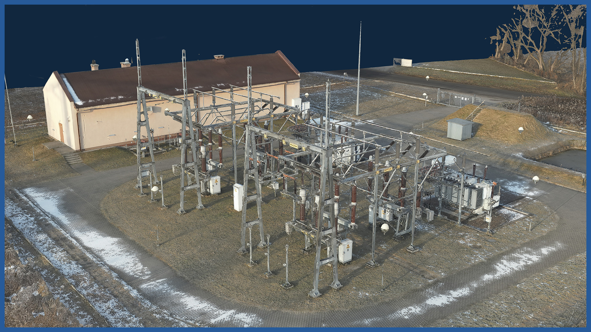
We make photorealistic 3D models of power substations and their surroundings. We use the technology of low-altitude photogrammetry supported by ground photogrammetry, the models have georeferenced data, which allows to embed them in a specific coordinate system.
They are characterized by high accuracy and detail.
The digital model can be used for visualization and presentation of the substation, as well as for more detailed and accurate analysis related to maintenance or reconstruction of the facility.
We use high-end cameras, so 3D models have very high-resolution textures where even the smallest details are visible. We supplement “tight” places, which the drone is not able to measure with ground photos. The combination of data from these two sources results in increased detail and validity of the model.
3D MODEL CHARACTERISTICS:
| Data format | 3ds / dae / obj / tls |
| Coordinate System | adapted to project |
| Vertical Reference System | adapted to project |
| Color palette | RGB / monochromatic / by elevation |
/ OTHER FROM ENERGETICS
Power lines:
– powerlines modeling
– calculating catenary parameters
– powerlines profiles
Electricity stations / traction substations:

