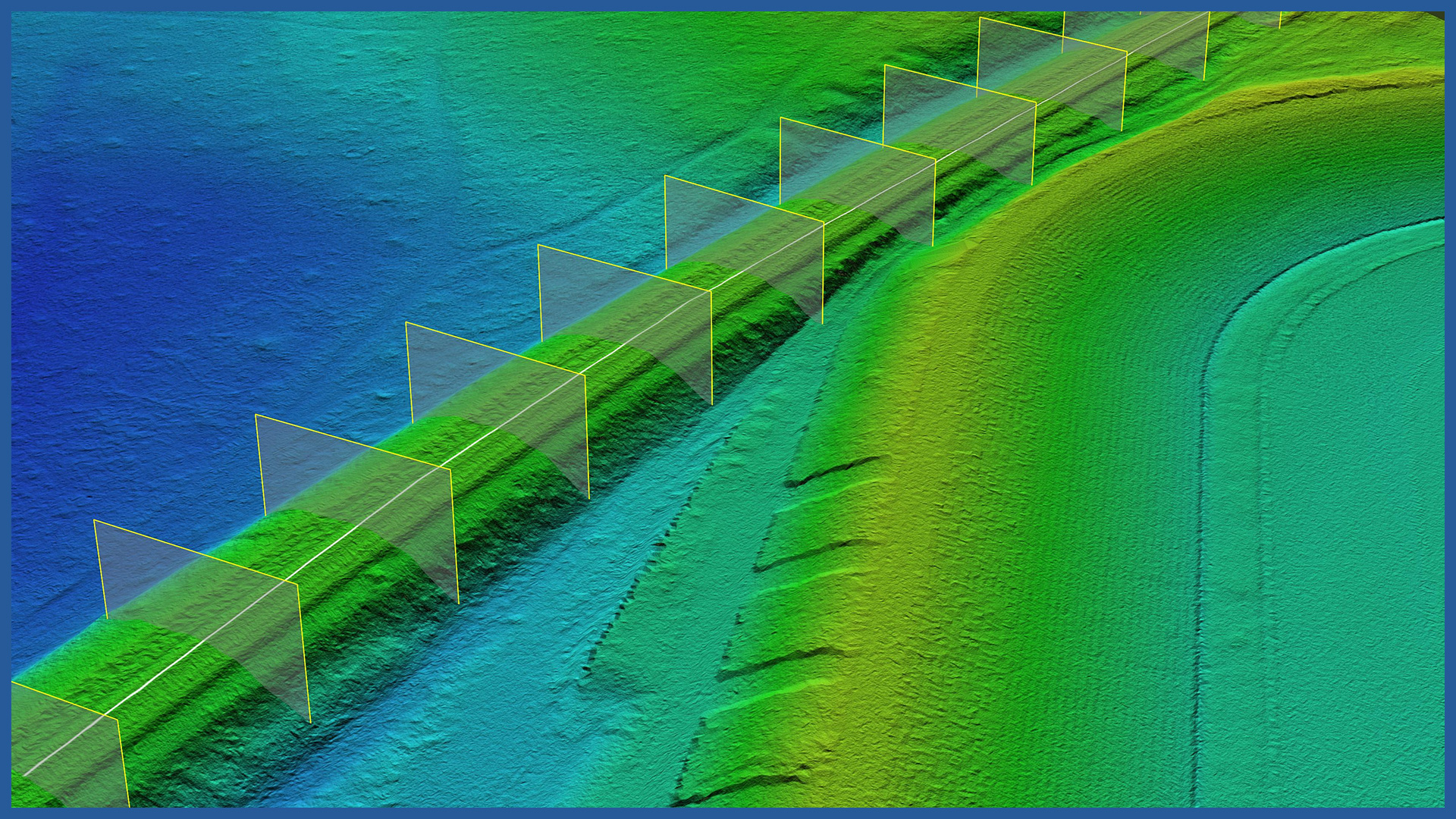
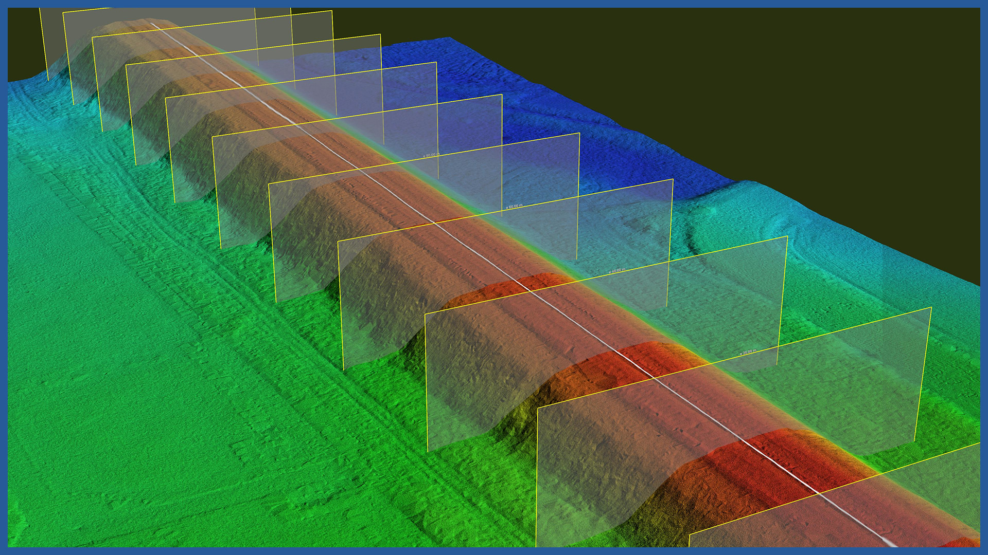
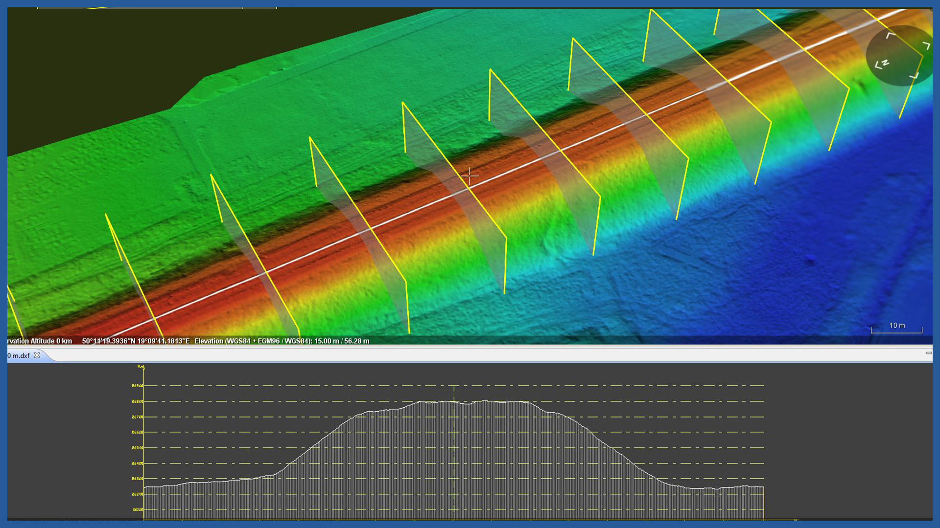
We perform cyclic laser scanning of the terrain allowing to balance earthworks in a very fast way. Measurements are characterized by full detail and maintain the accuracy of classical methods using GNSS receivers.
Accurate terrain model can be used to control the zero state accepted in the project and the completed works in relation to the project documentation. It can also serve as an independent detailed check of documentation performed by other methods, and thus prevent possible errors and resulting losses.
The speed of measurement carried out using aerial techniques allows us to document the status of railroad construction on a specific day and cover not only individual parts of the project, but its entire scope.
Periodic measurements allow us to perform a comparison of models from different days and calculate changes between them, including balance of works.
Settlement of the balance of earthworks and documentation can be made in the form of:
– tabular settlements between zero state and individual models
– calculations based on cross sections.
On the basis of the acquired data, we can make a number of depictions, for example: overburden and underburden zones, volumes and deviations of overburden zones, inclination of construction slopes.
The method is characterized by high accuracy and elimination of errors resulting from excessive generalization during measurement.
DSM / DTM CHARACTERISTICS:
| Data type | raster / vector |
| Data format | GeoTIFF / DWG / DXF / DTM |
| XY accuracy | <3 cm |
| Z accuracy | <3 cm |
| Coordinate System | adapted to project |
| Vertical Reference System | adapted to project |
POINT CLOUD CHARACTERISTICS:
| Point cloud density (LiDAR) | ~400 pts/m2 |
| Point cloud density (photogrammetry) | ~2500 pts/m2 |
| Accuracy | <3 cm |
| Data format | LAS / LAZ / E57 / TXT |
| Color palette | RGB / monochromatic / by elevation |
| Classification | ASPRS standard |
| Coordinate System | adapted to project |
/ OTHER FROM RAILWAY INFRASTRUCTURE
- high-resolution railway orthophotomaps
- dense point clouds
- digital terrain models
- zero measurement
- high-resolution photo/video documentation to assess the condition of the railroad:
– rails and railroad sleepers
– traction network and surrounding infrastructure
– bridges, viaducts, flyovers, engineering structures


